Salisbury Street Crane Placement Survey
In Raleigh, NC, mechanical contractor Newcomb and Company needed a crane to lift rooftop mechanical equipment for a downtown building renovation project near Salisbury Street.
In a space-constrained area, this proved to be a formidable challenge. The development team needed to calculate to exact distance between various buildings and gauge the distance to the street. Recommended by a trusted client, Bohler utilized UAS to perform LiDAR scans of the area.
Within 72 hours, Bohler’s surveyors provided point cloud data that measured the intersection down to the millimeter. This data allowed the client to insert a 3D crane model into the drawing, demonstrating where the crane would fit.
In the end, Bohler’s 3D LiDAR Scanning services had not just provided data; they had empowered their client to transform complex challenges into flawless executions.
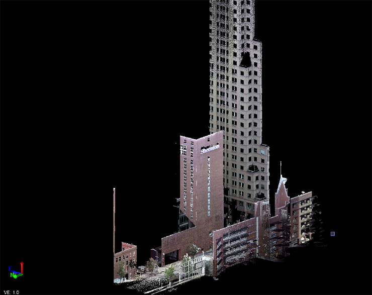 Southeastern view of Sheraton Hotel and surrounding building from Bohler’s terrestrial scanner
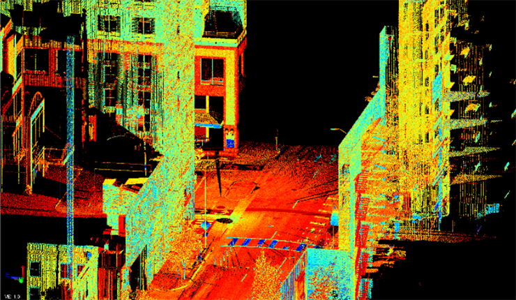 Street view of our terrestrial scan, shown in color coded intensity to highlight different site features
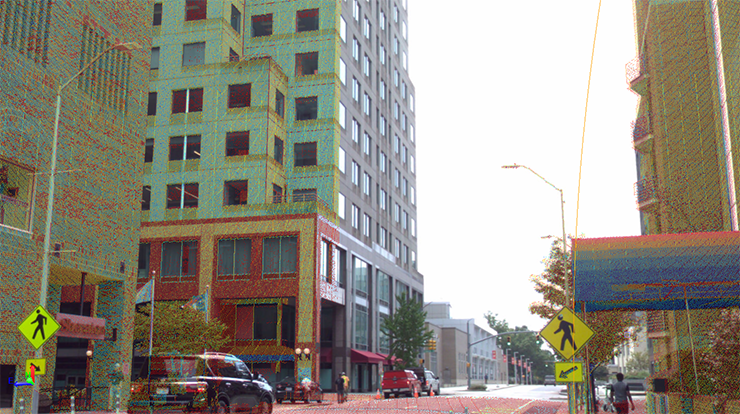 Street view from our terrestrial scanner highlighting actual photogrammetry view with color-coded point cloud overlay
Ready to Move Forward?
Our approach makes a meaningful difference for our most ambitious clients. Contact us to learn more.
Let's Get Started